📐
Surveying & mapping
High-precision land surveying and map building.
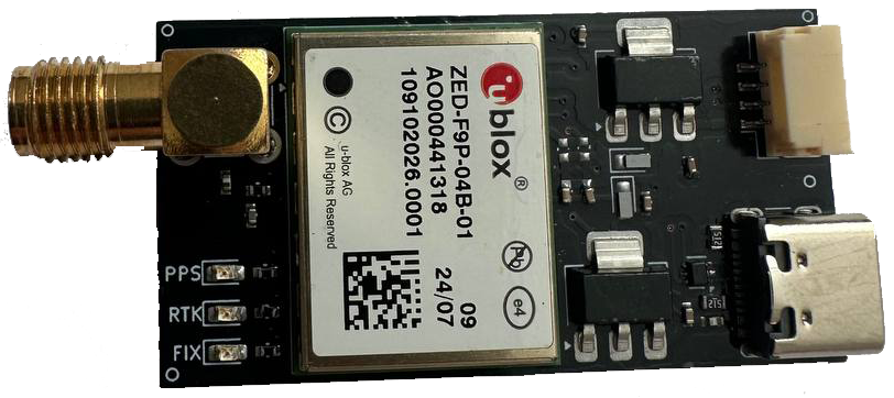
A production-ready multi-band RTK receiver based on the u-blox ZED-F9P (184 channels). It determines coordinates with centimeter accuracy and works as a base station (Base) or a rover — for surveying, UAVs, robotics, precision agriculture and autonomous vehicles.
High-precision land surveying and map building.
Precise drone positioning and image geo-referencing.
Navigation of autonomous platforms and manipulators.
Machinery autopilots and parallel driving.
Positioning for driverless and ground systems.
Deploying RTK infrastructure on site.
Send a request — we’ll answer your questions and provide a quote.
Request a quote